Bridgeport, Connecticut Flood Insurance: Your Complete2025 Guide
At The Flood Insurance Guru, we specialize in flood insurance for Bridgeport and Connecticut's coastal communities. As Connecticut's largest city by population with over 148,000 residents, Bridgeport faces unique dual flood risks from both the Housatonic River and Long Island Sound coastal flooding. Hurricane Sandy in October 2012 demonstrated Bridgeport's vulnerability when an 11-foot storm surge inundated coastal areas and caused extensive damage throughout the city. The South End neighborhood, home to more than 6,000 residents, experienced particularly severe flooding. This historic event reminded Bridgeport property owners that flood risk is real, ongoing, and requires proper insurance protection.
Bridgeport Flood Insurance Overview
Whether you own a historic home in downtown Bridgeport, a coastal property in the South End, a commercial building near the Housatonic River, or a property in Stratford, Fairfield, Shelton, or other surrounding communities, we provide expert guidance and competitive rates for all Bridgeport-area properties.
Bridgeport Flood Insurance Key Facts:
- Bridgeport faces dual flood risks: Housatonic River + Long Island Sound
- Hurricane Sandy's 11-foot storm surge (2012) caused extensive damage
- Zone VE coastal areas: $2,500-$10,000+ annual premiums
- Zone AE riverine areas: $800-$5,000 depending on elevation
- Zone X inland areas: $450-$800 annual premiums
- NFIP data: 1,669 policies, $1,055 average premium
- Historic floods: 1905 Housatonic River flood, 1955 hurricanes
- We serve Bridgeport, Stratford, Fairfield, Shelton, and surrounding communities
Understanding Bridgeport's Dual Flood Risks
Housatonic River Flooding
The Housatonic River flows through Bridgeport before emptying into Long Island Sound, creating significant flood risk along its banks and in low-lying areas influenced by the river. The river's flood history includes the devastating 1905 flood and numerous modern events.
Housatonic River Flood Risk Areas:
- Properties directly along the riverbank
- Low-lying areas near the river's mouth
- Areas influenced by tidal backwater from Long Island Sound
- Neighborhoods in the river's historic floodplain
The Housatonic River's flood risk is classified primarily as Zone AE, meaning areas with a 1% annual chance of flooding. Unlike coastal flooding, riverine flooding typically doesn't involve destructive wave action, resulting in somewhat lower premiums than coastal Zone VE areas.
Housatonic River Flood History:
- 1905 flood: Major Housatonic River flooding throughout the valley
- 1955 hurricanes: Connie and Diane brought heavy rainfall and flooding
- Tropical Storm Irene (2011): Moderate Housatonic River flooding
- Ongoing risk: Climate change projections show increasing flood frequency
Long Island Sound Coastal Flooding
Bridgeport's extensive Long Island Sound coastline creates significant coastal flood risk, especially during hurricanes and nor'easters. Coastal flooding combines high water levels with destructive wave action, creating the most severe flood hazard.
Hurricane Sandy (October 2012):
Hurricane Sandy remains Bridgeport's most significant recent flood event. The storm's 11-foot surge inundated coastal areas and caused catastrophic damage throughout the waterfront neighborhoods.
- Storm surge: 11 feet in Bridgeport
- Date: October 29, 2012
- Impact: Extensive damage to South End and coastal areas
- Homes destroyed or severely damaged: Hundreds
- Economic impact: Tens of millions of dollars
- Long-term effect: Increased flood insurance awareness and requirements
The South End neighborhood experienced particularly severe flooding during Sandy. Many homes were destroyed or rendered uninhabitable. Recovery took years, and some properties were never rebuilt.
Coastal Flood Risk Areas:
- South End neighborhood (highest risk)
- Black Rock neighborhood
- Downtown waterfront areas
- Any property within several blocks of Long Island Sound
- Areas in Zone VE (coastal high-hazard with wave action)
Coastal flood risk is classified as Zone VE (high-hazard with wave action) or Zone AE (high-hazard without significant wave action). Zone VE areas face the highest premiums due to the combination of flooding and destructive waves.
Combined River and Coastal Risk
Some Bridgeport properties face combined risk from both the Housatonic River and Long Island Sound coastal flooding. Areas near the river's mouth are particularly vulnerable, as storm surge can push water up the river while the river itself is flooding downstream.
This combined risk creates complex flood insurance scenarios where properties may be in Zone AE but face both riverine and coastal flooding depending on storm characteristics. Understanding your specific flood risk requires careful analysis of FEMA flood maps and local topography.
Bridgeport Flood Insurance Costs by Zone
Zone VE: Coastal High-Hazard Areas
Zone VE represents the highest-risk flood areas in Bridgeport—coastal areas subject to flooding plus destructive wave action during storms. Properties in Zone VE must meet strict building requirements including elevation on pilings or columns.
Zone VE Premium Ranges:
| Property Type | Elevation Status | Annual Premium Range |
|---|---|---|
| Single-family home | Properly elevated to current standards | $2,500–$5,000 |
| Single-family home | Elevated to older standards | $4,000–$7,000 |
| Single-family home | Not properly elevated | $7,000–$10,000+ |
| Multi-family property | Properly elevated | $4,000–$8,000 |
| Commercial property | Properly elevated | $5,000–$12,000+ |
Zone VE premiums are significantly higher due to extreme coastal flood risk. However, properly elevated structures receive large discounts.
Elevation Requirements for Zone VE:
- Lowest floor must be elevated to or above Base Flood Elevation (BFE)
- Structure must be on pilings, columns, or walls with flood vents
- Space below elevated floor must be free of obstruction
- Proper elevation can save $3,000–$5,000+ annually on premiums
Zone AE: Riverine and Non-Coastal High-Risk Areas
Zone AE areas have a 1% annual flood chance, primarily from the Housatonic River or inland flooding. These zones usually have lower premiums than coastal Zone VE.
Zone AE Premium Ranges:
| Property Elevation | Annual Premium Range | Example |
|---|---|---|
| Elevated above Base Flood Elevation | $800–$1,800 | Home 2 ft above BFE: $1,200/year |
| At Base Flood Elevation | $1,800–$3,500 | Property near Housatonic River: $2,800/year |
| Below Base Flood Elevation | $2,500–$5,000 | Older home 1 ft below BFE: $4,200/year |
| Commercial (elevated) | $2,000–$4,500 | Commercial above BFE: $3,200/year |
| Commercial (at/below BFE) | $3,500–$8,000 | Commercial at BFE: $5,800/year |
The main factor determining your Zone AE premium is elevation. An elevation certificate showing favorable elevation can reduce your cost by $1,500–$3,500 annually.
Zone X: Moderate and Low-Risk Areas
Zone X areas are outside the high-risk floodplain but may still flood during severe storms. Much of inland Bridgeport falls into Zone X, making flood insurance affordable.
Zone X Premium Ranges:
| Property Type | Coverage Amount | Annual Premium Range |
|---|---|---|
| Single-family home | $250,000 building | $450–$800 |
| Multi-family (2–4 units) | $400,000 building | $650–$1,300 |
| Commercial property | $500,000 building | $900–$1,800 |
For most Bridgeport Zone X properties, flood insurance costs under $70/month—a small price for valuable financial protection.
Bridgeport Neighborhoods and Flood Risk
South End
The South End is Bridgeport's most flood-vulnerable neighborhood, with more than 6,000 residents living in areas subject to coastal flooding from Long Island Sound. Hurricane Sandy devastated the South End in 2012, with hundreds of homes damaged or destroyed by the 11-foot storm surge.
South End Flood Risk:
- Extensive Zone VE coastal high-hazard areas
- Some Zone AE areas farther from the immediate coastline
- Highest flood insurance premiums in Bridgeport
- Many properties rebuilt after Hurricane Sandy with proper elevation
South End Flood Insurance Costs:
- Zone VE properties: $2,500–$10,000+ depending on elevation
- Zone AE properties: $1,200–$4,500 depending on elevation
- Properly elevated post-Sandy construction: $2,500–$4,000 typical
If you own property in Bridgeport's South End, proper elevation is essential for both flood protection and affordable insurance. Properties rebuilt after Hurricane Sandy with proper elevation receive significantly better rates than older, non-elevated structures.
Downtown Bridgeport
Downtown Bridgeport includes commercial districts, government buildings, and mixed-use properties. Some downtown areas face flood risk from the Housatonic River and coastal flooding, while others are at higher elevation with lower risk.
Downtown Flood Risk:
- Mixed zones: Some Zone AE, some Zone X
- Housatonic River influence in low-lying areas
- Commercial properties require specialized coverage
Downtown Flood Insurance Costs:
- Zone AE commercial: $2,500–$8,000 depending on elevation and building value
- Zone X commercial: $900–$2,000 typical
- Multi-story buildings: Lower floors face higher risk and premiums
Black Rock
Black Rock is a Bridgeport neighborhood with Long Island Sound coastline, creating coastal flood risk similar to the South End but generally with less extensive Zone VE areas.
Black Rock Flood Risk:
- Some Zone VE coastal areas
- Zone AE areas near the coast
- Zone X areas farther inland
Black Rock Flood Insurance Costs:
- Zone VE properties: $2,500–$8,000 depending on elevation
- Zone AE properties: $1,000–$3,500 depending on elevation
- Zone X properties: $500–$850 typical
Other Bridgeport Neighborhoods
We serve all Bridgeport neighborhoods including East Side, West Side, North End, and surrounding areas. Flood risk and insurance costs vary significantly by location, with coastal and riverfront areas facing the highest risk and premiums.
Surrounding Communities We Serve
Stratford
Stratford borders Bridgeport to the east and shares similar coastal flood risk from Long Island Sound plus the Housatonic River, which forms part of the Bridgeport-Stratford border. Stratford experienced significant flooding during Hurricane Sandy.
Stratford Flood Insurance Costs:
• Zone VE coastal properties: $2,500–$9,000
• Zone AE properties: $900–$4,000 depending on elevation
• Zone X properties: $450–$800
Fairfield
Fairfield is an affluent coastal community west of Bridgeport with extensive Long Island Sound coastline. Fairfield's higher property values often require coverage above NFIP's $250,000 limit, making private insurance particularly valuable.
Fairfield Flood Insurance Costs:
• Zone VE coastal properties: $3,000–$12,000+ (higher due to property values)
• Zone AE properties: $1,200–$5,000
• Zone X properties: $500–$900
Shelton
Shelton is located inland along the Housatonic River, facing riverine flood risk without coastal exposure. Shelton's flood risk is generally lower than coastal communities, resulting in more affordable premiums.
Shelton Flood Insurance Costs:
• Zone AE Housatonic River properties: $800–$3,500 depending on elevation
• Zone X properties: $400–$700
Hurricane Sandy's Lasting Impact on Bridgeport Flood Insurance
Hurricane Sandy fundamentally changed flood insurance in Bridgeport. Before Sandy, many coastal property owners either didn't have flood insurance or had minimal coverage. After Sandy, the reality of coastal flood risk became impossible to ignore.
What Changed After Hurricane Sandy:
- ✓ Increased Awareness: Property owners throughout Bridgeport's coastal areas now understand that catastrophic flooding can happen and that flood insurance is essential protection.
- ✓ Updated Flood Maps: FEMA updated flood maps after Hurricane Sandy, expanding Zone VE and Zone AE areas to reflect actual flood risk demonstrated by the storm.
- ✓ Higher Premiums: Properties in coastal areas saw significant premium increases as FEMA's Risk Rating 2.0 system better accounts for coastal flood risk and storm surge.
- ✓ Building Requirements: Properties substantially damaged by Hurricane Sandy had to be rebuilt to current elevation standards, improving flood resistance but also confirming high-risk status.
- ✓ Lender Requirements: Lenders became much more strict about enforcing flood insurance requirements for properties in high-risk zones.
Lessons from Hurricane Sandy for Bridgeport Property Owners:
Lesson 1: Flood insurance is essential
Many Bridgeport property owners who lacked
flood insurance during Hurricane Sandy lost everything. Those with flood insurance were
able to rebuild.
Lesson 2: Coverage limits matter
Some property owners had flood insurance but insufficient coverage limits, leaving them underinsured when catastrophic damage
occurred.
Lesson 3: Elevation saves money and provides protection
Properties properly elevated above Base Flood Elevation fared much better during Hurricane Sandy and pay lower
premiums.
Lesson 4: "It won't happen to me" is dangerous thinking
Many Bridgeport residents thought their properties wouldn't flood—until they did.
Lesson 5: Recovery takes years.
Even with flood insurance, recovering from catastrophic flooding is a multi-year process. Prevention through proper elevation is better than recovery.
How to Get the Best Bridgeport Flood Insurance Rate
Step 1: Verify Your Flood Zone (Free)
The first step is knowing your property's official FEMA flood zone. We provide a free flood zone assessment for any Bridgeport address using current FEMA flood maps.
Your free flood zone assessment tells you:
• Your official FEMA flood zone (VE, AE, X, etc.)
• Whether flood insurance is required by your lender
• Your approximate premium range
• Whether an elevation certificate would help
• What your Base Flood Elevation is (for Zone VE and AE properties)

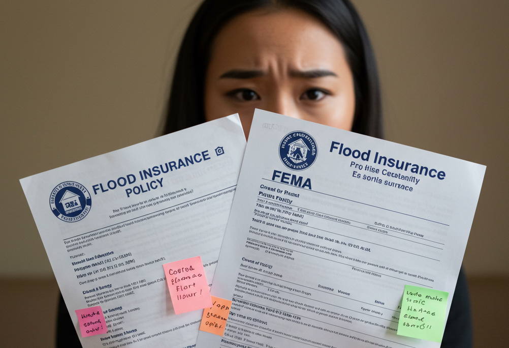
Step 2: Get an Elevation Certificate (Essential for Zone VE and AE)
If your Bridgeport property is in Zone VE or Zone AE, an elevation certificate is often essential for getting accurate flood insurance pricing. An elevation certificate is a survey document that shows your property's elevation relative to the Base Flood Elevation.
How Elevation Certificates Save Money:
Bridgeport Zone VE Example:
• Coastal property in Zone VE
• Premium without elevation certificate: $8,500/year
• Elevation certificate shows property properly elevated 3 feet above BFE
• New premium with elevation certificate: $3,200/year
• Annual savings: $5,300
• Elevation certificate cost: $750-$1,000
• Payback period: Less than 2 months
Bridgeport Zone AE Example:
• Housatonic River property in Zone AE
• Premium without elevation certificate: $3,400/year
• Elevation certificate shows property 1.5 feet above BFE
• New premium with elevation certificate: $1,400/year
• Annual savings: $2,000
• Payback period: 5-6 months
Who Needs an Elevation Certificate in Bridgeport:
• All Zone VE properties (essential)
• Zone AE properties that may be elevated above BFE
• Properties rebuilt or renovated after Hurricane Sandy
• Properties built after 2000
• Properties on elevated foundations
Elevation Certificate Cost in Connecticut: $750-$1,200 depending on property complexity and coastal location.
Step 3: Compare NFIP vs Private Insurance
We quote both NFIP and private flood insurance for your Bridgeport property so you can compare options and choose the best value.
NFIP (National Flood Insurance Program):
• Federally backed coverage
• Standardized terms
• Coverage limits: $250,000 building / $100,000 contents (residential)
• Available in all zones including highest-risk Zone VE
• Accepted by all lenders
Private Flood Insurance:
• Often lower premiums for certain properties
• Higher coverage limits (important for Bridgeport's higher-value coastal properties)
• More flexible terms
• Faster claims processing
• Selective underwriting—not all properties qualify
Bridgeport NFIP vs Private Comparison Examples:
| Property Type | NFIP Premium | Private Premium | Savings |
|---|---|---|---|
| Zone X inland property | $700/year | $480/year | $220/year (31%) |
| Zone AE elevated above BFE | $1,600/year | $1,100/year | $500/year (31%) |
| Zone VE properly elevated | $3,800/year | $3,200/year | $600/year (16%) |
| Zone AE at BFE | $3,500/year | $3,400/year | $100/year (3%) |
| Zone VE not properly elevated | $9,000/year | Not available | N/A |
Our Recommendation: Always compare both options. We provide side-by-side quotes with identical coverage limits so you can make an informed decision for your Bridgeport property.
Bridgeport Flood Insurance
Why is flood insurance so expensive in Bridgeport's coastal areas?
Coastal flood insurance is expensive because coastal flooding combines high water levels
with destructive wave action, creating extreme risk. Hurricane Sandy demonstrated this
risk when an 11-foot storm surge devastated Bridgeport's South End. Zone VE areas face the highest premiums because they're subject to both flooding and waves capable of
destroying structures.
However, proper elevation dramatically reduces premiums. A Zone VE property properly elevated to current FEMA standards might pay $3,000-$4,000 annually, while a non-elevated property in the same area might pay $8,000-$10,000+ annually. Elevation certificates documenting proper elevation are essential for getting accurate pricing.
Can I get flood insurance if my Bridgeport property was damaged by Hurricane Sandy?
Yes. Previous flood damage, including Hurricane Sandy damage, doesn't disqualify you from getting flood insurance. However, properties with flood history typically pay higher premiums because they've demonstrated actual flood risk.
If your property was substantially damaged by Hurricane Sandy and rebuilt to current
elevation standards, you may actually qualify for better rates than before because the
rebuilt structure is properly elevated. An elevation certificate documenting your post-Sandy elevation improvements is essential for getting proper credit.
Do I need flood insurance if I'm several blocks from Long Island Sound?
Possibly yes. FEMA flood zones extend well beyond the immediate coastline based on
topography, elevation, and storm surge modeling. Hurricane Sandy's 11-foot storm surge reached properties several blocks inland from Long Island Sound.
If your property is in Zone VE or Zone AE, you need flood insurance if you have a mortgage—
regardless of how many blocks you are from the water. Even if you're in Zone X (moderate
or low risk), flood insurance is recommended as affordable protection. We provide free flood zone determinations to tell you exactly what zone your Bridgeport property is in.
What's the difference between building coverage and contents coverage?
Building coverage protects your structure including walls, roof, foundation, electrical
systems, plumbing, HVAC, built-in appliances, and permanently installed items. Building
coverage is required by your lender if you have a mortgage in a high-risk flood zone.
Contents coverage protects your personal belongings including furniture, clothing,
electronics, appliances, and other movable items. Contents coverage is optional but
strongly recommended—flood damage to contents can be just as expensive as structural damage.
Coverage Limits:
• NFIP Building: Up to $250,000 (residential) / $500,000 (commercial)
• NFIP Contents: Up to $100,000 (residential) / $500,000 (commercial)
• Private Insurance: Often higher limits available
Most Bridgeport property owners should have both building and contents coverage for
comprehensive protection.
How long does it take for flood insurance to take effect?
Flood insurance policies typically have a 30-day waiting period before coverage begins. If you request a quote today and bind a policy, coverage would start 30 days from the policy
effective date.
Exceptions to the 30-day waiting period:
• New mortgage closing (no waiting period)
• Newly mapped property (limited time to purchase without waiting period)
• Policy renewal (no waiting period)
• Certain FEMA disaster declarations
Don't wait for a hurricane forecast to buy flood insurance. The 30-day waiting period
means you must purchase coverage before you need it. Buy now while you have time, and you'll be protected when the next coastal storm approaches Bridgeport.
Should I choose NFIP or private flood insurance for my Bridgeport property?
The answer depends on your specific property. We recommend quoting both options and comparing them side-by-side.
NFIP may be better if:
• Your property is in Zone VE or very high-risk Zone AE
• Your property has flood claims history
• Your property is not properly elevated
• You need exactly $250,000 building / $100,000 contents coverage
Private insurance may be better if:
• Your property is in Zone X or lower-risk Zone AE
• Your property is properly elevated above BFE
• Your property is worth more than $250,000 and you need higher limits
• Your property is newer construction meeting modern standards
We provide side-by-side comparisons with identical coverage limits so you can make an
informed decision for your Bridgeport property.
Will an elevation certificate help my Bridgeport property?
Very likely yes, especially if you're in Zone VE or Zone AE. Elevation certificates are essential for:
Zone VE properties: Absolutely essential. Without an elevation certificate, you'll be
charged maximum rates. With proper documentation of elevation, you could save
$3,000-$6,000 annually.
Zone AE properties: Very valuable if you're elevated above BFE. Potential savings of
$1,500-$3,500 annually.
Zone X properties: Generally not needed, as Zone X premiums are already low.
We can assess whether an elevation certificate is likely to help your Bridgeport property before you invest $750-$1,200 in obtaining one.
Why Bridgeport Property Owners Choose The Flood
Insurance Guru
Bridgeport homeowners, investors, and business owners choose us because we understand coastal and riverine flood insurance and provide clear guidance without pressure.
We Understand Bridgeport's Unique Flood Risks
We specialize in coastal and riverine flood insurance, which means we understand:
• Hurricane Sandy's impact and lessons learned
• Zone VE coastal high-hazard requirements
• Housatonic River flood risk
• Elevation requirements for coastal properties
• How to navigate FEMA's complex Risk Rating 2.0 system
We Compare NFIP and Private Insurance
If your Hartford property has filed flood claims in the past, NFIP's standardized rating may be more favorable than private carriers, which often charge significant surcharges for properties with claims history.
We Handle Everything
From flood zone determinations to elevation certificate guidance to policy binding and lender coordination, we manage the entire process for your Bridgeport property.
We're Educators First
We want you to understand your flood risk and coverage options so you can make confident decisions about protecting your Bridgeport property.
We Provide Ongoing Support
Questions about your coverage? Need to file a claim? Making property changes? We're here to help throughout your policy term.
Get Your Free Bridgeport Flood Insurance Quote Today
Protect your Bridgeport property with the right flood insurance at the best price.
What You'll Get:
- ✅ Free flood zone determination for your Bridgeport address
- ✅ Side-by-side quotes comparing NFIP and private insurance
- ✅ Expert guidance on elevation certificates
- ✅ Answers to all your questions about Bridgeport flood insurance
- ✅ No-pressure education about your options
- ✅ Professional service from flood insurance specialists
Three Easy Ways to Get Started:
Call Us: (205) 451-4294
Speak directly with a flood insurance specialist who understands Bridgeport's coastal risks.
Request a Quote Online:
Visit www.floodinsuranceguru.com and complete our quick quote form.
Email Us:
Send your Bridgeport address and questions to contact@floodinsuranceguru.com.
What Happens Next:
- We'll determine your flood zone using current FEMA maps
- We'll quote both NFIP and private insurance for your property
- We'll present your options with clear pricing and recommendations
- You'll choose the coverage that's right for your Bridgeport property
- We'll handle all the paperwork and coordination
- Your coverage will be in place within 30 days (or immediately for mortgage closings)
Don't wait for the next Hurricane Sandy. Protect your Bridgeport investment today with flood insurance that's right for your property and your budget.